 |
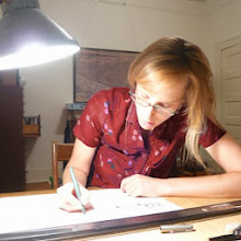
| During the summer of 2013, I drew in pencil all the building visible in the aerial underlay. Over half were obscured by trees. Sometimes, I kind of guessed. |
 |
| The impetus to begin again in March 2014 was a batch of aerial photographs sent by the client to help me fill in the many missing buildings. |
 |
| And so I drew, block by block, street by street. |
 |
 |
 |
| I picked out a few houses I liked...noticing a definite Maine [Eastport] vernacular. |
 |
 |
| I didn't realize how many I took! It's just such a beautiful place, lovely time of year. |
 |
| BEFORE AFTER More than occasionally, I realized the scale was off. The buildings I'd just drawn were too small or too large. This is more art than science. |
 |
| I ended up with many tiny off-scale buildings floating around my drawing table. They are still turning up between the floor boards. |
 |
| The South End of Moose Island, just beyond the central core of Eastport was totally obscured in the composite aerial underlay. So, this neighborhood was drawn fresh from the digital images. |
 |
| The receding view makes the land beyond Eastport appear completely forested. Drawing trees was sometimes a relief from drawing buildings in perspective. Until the end....when I had over 600 to draw. |
 |
 |
 |


.jpg)


4 comments:
I approve, That will be all.
I approve. A that will be all.
I LOVE your work!! I wish I could draw like that. Your art is amazing!!
oh, this is gorgeous. thank you for explaining the process, which is also gorgeous.
Post a Comment